Mozambique Wildlife Tracking System
Comprehensive wildlife tracking and monitoring infrastructure deployed for the Government of Mozambique, enabling cross-border conservation coordination.
Project Overview
UBERT Technologies partnered with the Government of Mozambique to deploy a nationwide wildlife tracking system covering key conservation areas. The project integrated GPS satellite tracking with cloud-based analytics to provide government officials and park rangers with real-time intelligence.
The Challenge
Mozambique’s vast wilderness areas required a scalable monitoring solution that could operate across diverse terrain while maintaining data sovereignty requirements mandated by the government. Traditional monitoring methods were insufficient for the scale of protected areas that needed coverage.
Our Solution
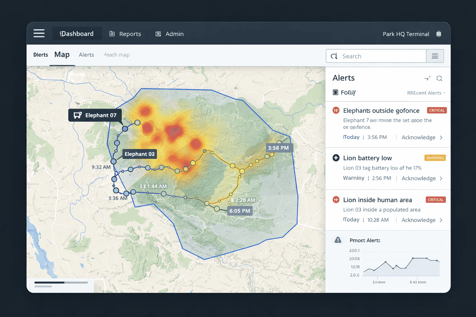
- Distributed GPS Network: Multi-zone satellite tracking covering major conservation corridors across Mozambique’s priority reserves.
- Government Dashboard: Centralized command center providing wildlife management officials with real-time visibility into animal movements and threat detection.
- Cross-Border Coordination: Data sharing protocols established with neighboring countries for tracking migratory species and coordinating anti-poaching efforts.
- Local Training: Comprehensive capacity building program ensuring Mozambican technical staff could independently operate and maintain the system.
The deployment enhanced protected area surveillance and significantly reduced poaching activity across priority reserves, establishing a model for technology-driven conservation across Southern Africa.
Technologies
Key Outcomes
- ✓ Multi-Region Coverage
- ✓ Government Dashboard
- ✓ Anti-Poaching Coordination
- ✓ Data Sovereignty Compliance